The River Pont and Ponteland's Floods: Defences, Risk and What to Check
The River Pont gave Ponteland its name, and from time to time it floods. A practical guide to the town's flood history, the £2.7m flood wall completed in 2021, and how residents and buyers can check flood risk and sign up for warnings.
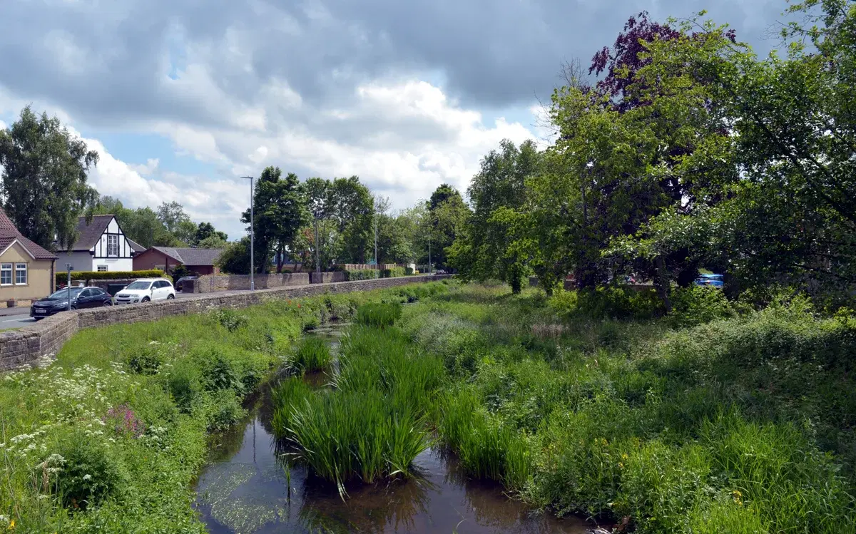
Ponteland is named after its river. The Pont runs right through the middle of the town, past St Mary's Church, under the road bridge by the Diamond Inn and through Ponteland Park, and most of the time it is a quiet, shallow stream. But like many rivers in Northumberland, it can rise quickly after heavy rain, and parts of the town have flooded in the past.
This guide is not meant to alarm anyone. Most homes in Ponteland are nowhere near the river, and the riverside stretch that has flooded most often now has a modern flood wall. It is meant to be practical: a short history, what the defences do, and the simple steps residents and house-hunters can take to check their own risk.
A town built around a river
The Pont rises near Great Whittington, flows past Stamfordham and through Ponteland, and joins the River Blyth near Berwick Hill, about 17 miles from its source. In the centre of Ponteland, Ponteland Park covers 18 acres on both banks of the river. The park was developed from 1958, and its riverside paths are among the most popular short walks in town. Our guide to the best walks in Ponteland includes several that follow the river.
The town's neighbourhood plan notes that "the Pont has flooded on a number of occasions and flood prevention works have been carried out on several stretches of the riverbank". It also records that the Eland Haugh estate was built on the river's flood plain.
September 2008
The highest river level on record in Ponteland came in September 2008. The Environment Agency's river gauge on Callerton Lane recorded its highest level on record, 2.24 metres, at around midnight on 7 September 2008.
The Environment Agency later drew up plans to improve protection for the homes closest to the river on the south bank. In January 2019 it held a public drop-in session at the Memorial Hall to show residents the plans.
The flood wall: what was built
Work on the Ponteland flood alleviation scheme began at the end of August 2020. The £2.7 million project replaced the existing defences along the south bank of the Pont, beside Callerton Lane, between Callerton Lane and the footbridge by Ponteland Memorial Hall.
The main feature is a continuous sheet-piled wall. The Environment Agency designed its foundations so that the wall can be raised in future if the risk of flooding increases. When the scheme was finished, the wall was given a stone-effect finish and the bank was re-profiled as a planted terrace so that it would sit better in the riverside setting.
Building the wall meant felling around 40 trees along the bank. The Environment Agency committed to planting five new trees for every one removed, and by the time the scheme was finished more than 250 trees had been planted in and around Ponteland, along with a wildflower meadow at a local primary school.
The scheme was completed in September 2021. The Environment Agency says it gives better protection to more than 250 homes and businesses.
Best for: Ponteland's £2.7m flood wall runs along the south bank of the River Pont beside Callerton Lane. It was completed in September 2021 and better protects more than 250 homes and businesses.
Better protected, not flood-proof
When the scheme was completed, the Environment Agency's project manager acknowledged the town's long history of flooding and was clear that flood risk can be reduced but never eliminated. That is true of every flood defence. A wall built to a certain standard can be overtopped by a bigger flood, and surface water from very heavy rain can cause problems away from the river altogether.
So it is worth knowing your own risk, even if you live in an area that has never flooded.
How to check flood risk for an address
The government's Check your long term flood risk service on GOV.UK shows the risk for any address in England from rivers and the sea, from surface water, and, where data exists, from groundwater and reservoirs. Enter a postcode and you get a rating for each source of flooding. It is the first thing to look at if you are buying or renting near the Pont.
For buyers, a few other checks are sensible:
- Ask the seller. The standard property information form asks whether a property has ever flooded. Ask follow-up questions about when and how.
- Look at the insurance. Ask what buildings insurance the current owner has and whether flood cover has ever caused problems.
- Read the search results. Your conveyancer's environmental search will report flood risk for the property.
- On Darras Hall, mind the watercourses. The estate's byelaws say that piping or diverting any stream needs consent from both the Environment Agency and the Estate Committee, and new houses need a flood risk assessment. Our guide to buying a house on Darras Hall explains the rules.
Flood warnings and live river levels
The Environment Agency runs flood warnings for England. You can sign up on GOV.UK to get warnings by phone call, text or email for your home or business, or call Floodline on 0345 988 1188 (textphone 0345 602 6340). Floodline is a 24-hour service.
The GOV.UK Check for flooding service shows any current flood alerts and warnings, and the latest readings from river gauges, including the one on the Pont at Callerton Lane. It is worth bookmarking in a wet autumn or winter.
Flood alerts and warnings come in three levels:
- Flood alert: flooding is possible. Be prepared.
- Flood warning: flooding is expected. Act now.
- Severe flood warning: a danger to life.
Best for: Floodline, the Environment Agency's 24-hour flood warning line, is on 0345 988 1188.
Flood wardens
Ponteland has volunteer flood wardens who keep an eye on the river and help neighbours when a flood is expected. In 2020 one of them told the Environment Agency that there were eight wardens in the town. Anyone interested in volunteering can contact the Environment Agency's North East engagement team at engagement_northeast@environment-agency.gov.uk.
Living with the river
The Pont is one of the best things about Ponteland. It is the reason the town is here, it runs through the park and past the church, and it gives the old village its character. Living near it simply means knowing the risk, signing up for warnings, and knowing what to do on the rare occasions the water rises.
If you are new to the town, our moving to Ponteland guide covers everything else you need to know.
Sources: Environment Agency announcements on the Ponteland flood alleviation scheme (2019 to 2021), the Ponteland Neighbourhood Plan, and Environment Agency river gauge records for Callerton Lane. Have photos or memories of floods in Ponteland? Get in touch.
Local businesses mentioned
Never miss what’s on
Join the weekly Ponteland.live digest — the best events, news and local tips, straight to your inbox. One email a week.
What's On
Ponteland Memorial Hall Quiz Night
7:00 PM · Ponteland Memorial Hall, Darras Road, Ponteland, NE20 9NX
Callerton Garden and Flower Club: Holly, Ivy and Santa
2:00 PM · Ponteland CIU, Merton Way, Ponteland, Newcastle upon Tyne
Ponteland Rep: A Musical Christmas Carol
7:00 PM (also 14 Nov 2:00 PM & 7:00 PM, 15 Nov 2:00 PM) · Ponteland Memorial Hall, Ponteland, Newcastle upon Tyne